Dundas Connects
Dundas Connects
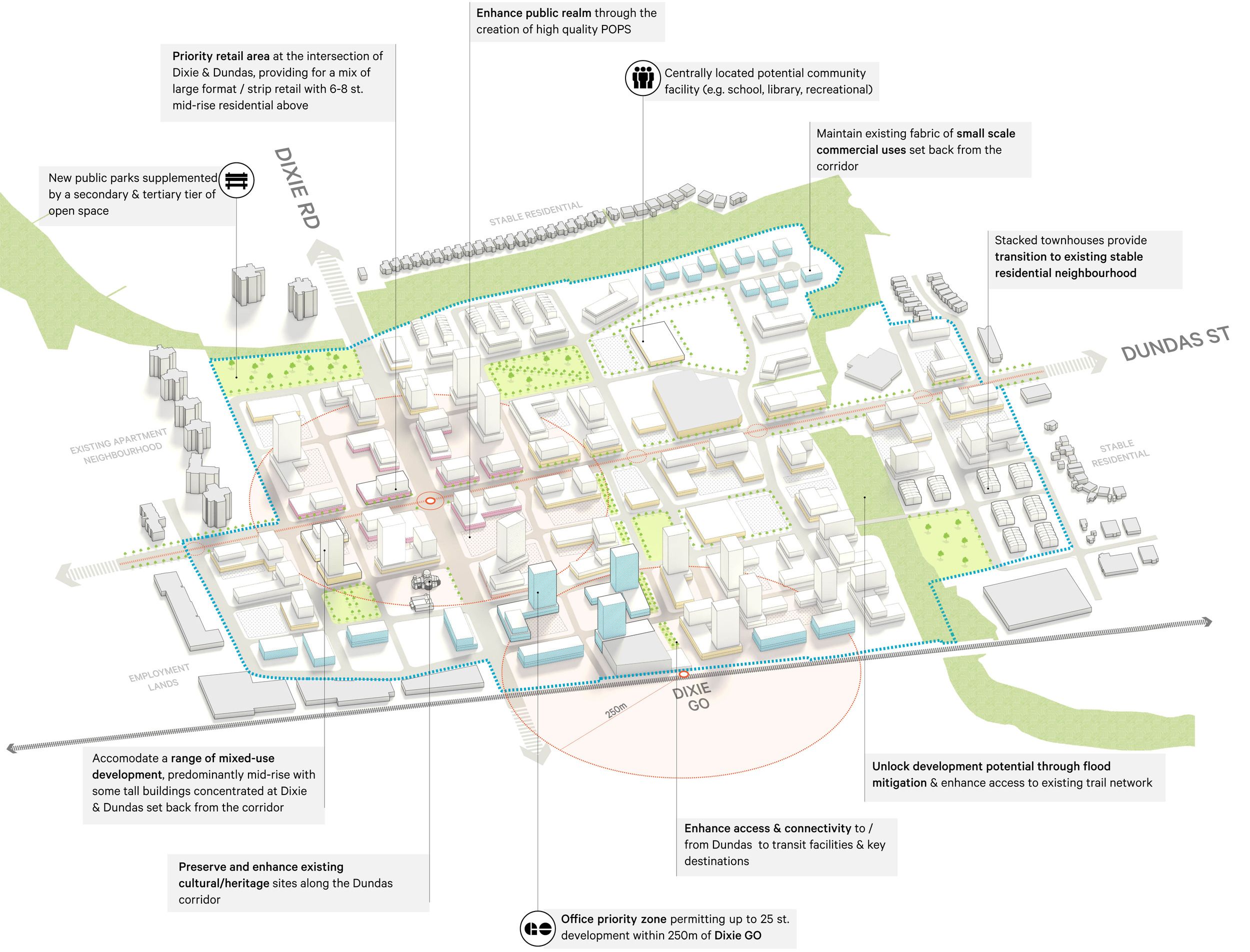
We created clear, practical guidelines for development along the 17-kilometer corridor that address everything from flooding concerns to streetscape improvements. The framework makes the approval process predictable for developers while ensuring new projects contribute to transit ridership and community life. By balancing growth with livability, we ensure that intensification makes neighborhoods stronger rather than overwhelming them with change.
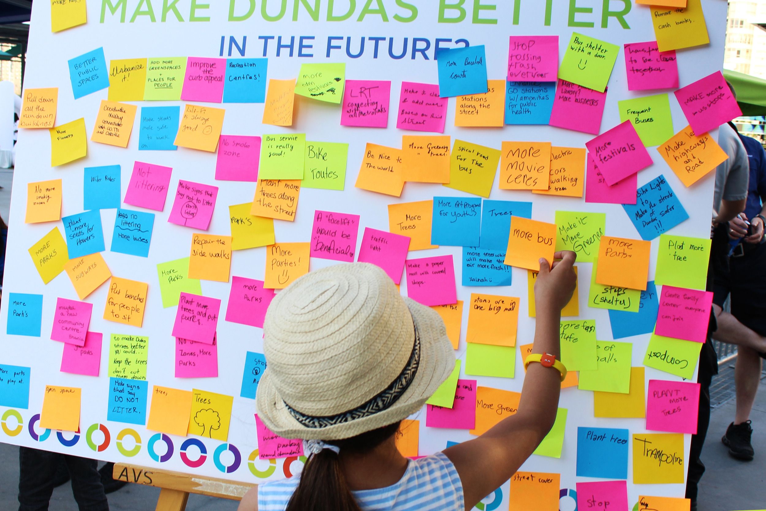
Real change happens when communities have a voice. We designed an extensive consultation process that reached nearly 10,000 residents through sixty events, online tools, and social media. This comprehensive approach brought in voices often left out of planning processes, especially youth and newcomers. The result is a vision for Dundas that truly reflects Mississauga's diversity. Our engagement approach has become a model for future city planning projects, showing how inclusive consultation builds support for positive change.
Mississauga's Dundas Street reflects decades of suburban growth, from quiet neighborhoods to shopping malls to apartment towers. Rather than seeing this mix as a problem, we embraced it as an opportunity to create a plan that respects existing communities while enabling smart growth. We looked at the big picture across the entire corridor while also focusing on seven key areas with unique challenges. This approach ensures new development fits well with what's already there while building the population density needed for better transit.

Having the right planning framework - simple to use and easy to implement - was essential for encouraging growth along the corridor and making a case for transit and other improvements.
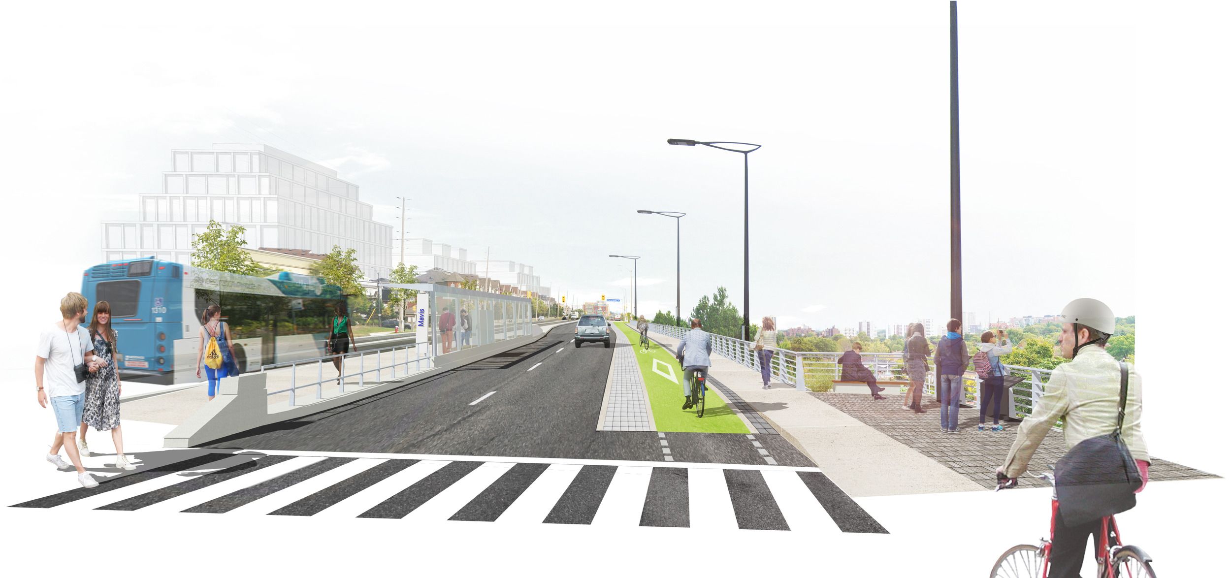
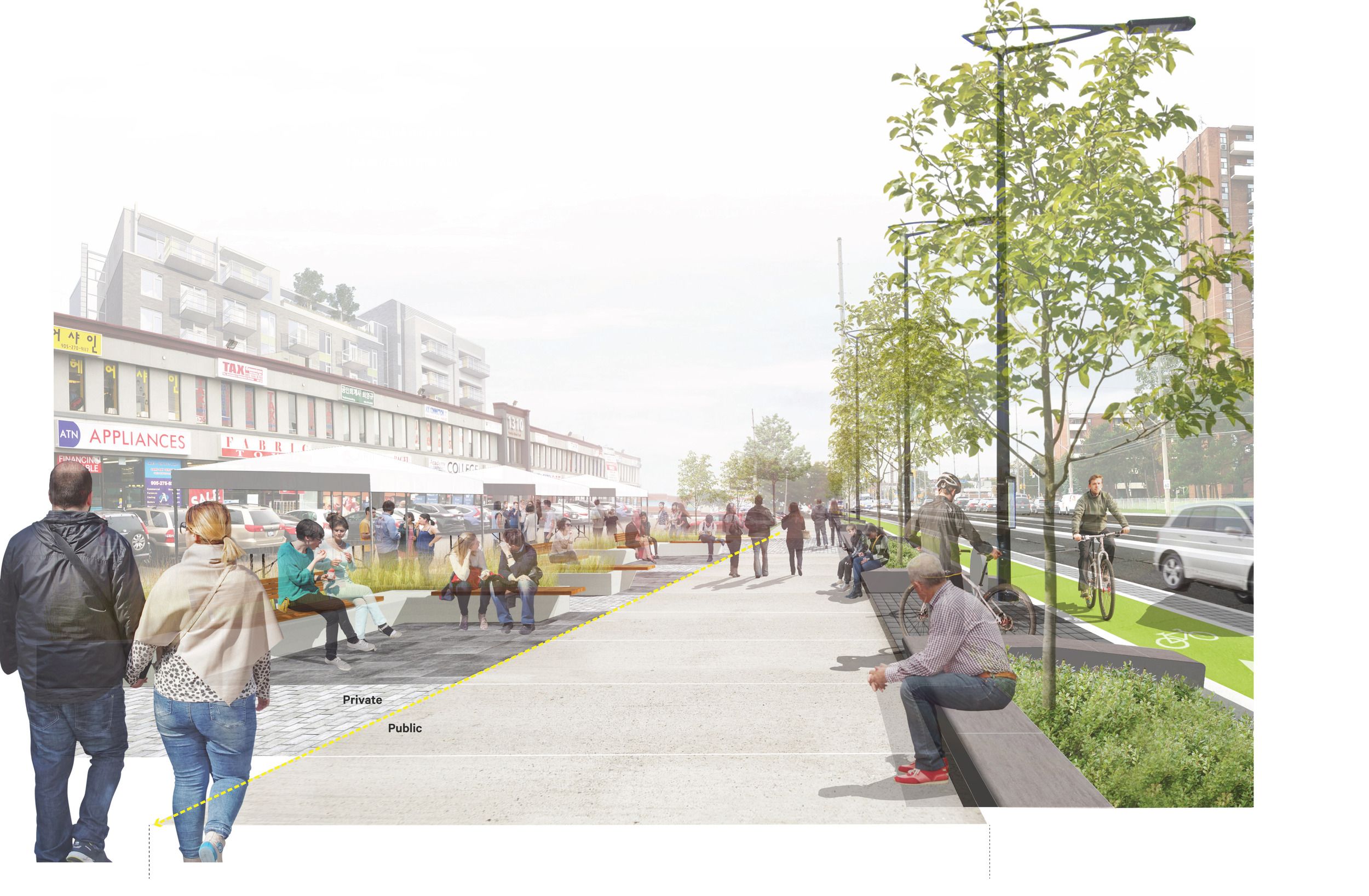
The plan shows how smart growth can make transit work in suburban areas. By focusing development around future transit stops and adding better walking and cycling connections, we created the foundation for bus rapid transit. The new streetscape design includes dedicated bus lanes, protected bike paths, and improved sidewalks that transform Dundas from a car-focused road into a street that works for everyone. This proves suburban corridors can evolve to serve both regional travel and local community needs.